Road Management Software UK | BORIS
GPS-Enabled Field Operations for Highways Teams
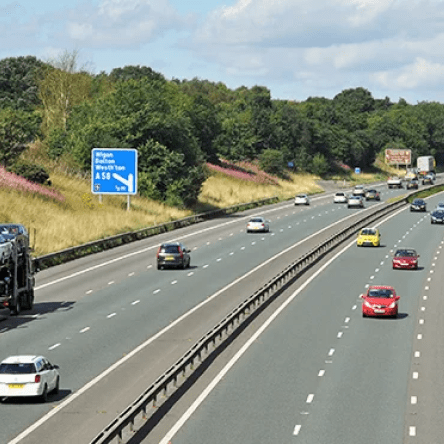
Local authorities, highways maintenance contractors, and regional road operators manage complex networks of A-roads, B-roads, and residential streets. Every pothole, street light, drainage gully, and road sign must be inspected, logged, and maintained to keep traffic flowing safely. Yet many teams still rely on paper inspection sheets, fragmented asset databases, and manual scheduling.
The problem is visibility. Without real-time data from the field, you don’t know which roads are deteriorating fastest, which crews are working where, or whether safety-critical repairs are completed on time. The cost of poor road management isn’t abstract—it’s potholes, accidents, and liability claims.
BORIS delivers the mobile-first, real-time visibility highways teams need. Four core modules keep your road network safe and compliant:
- Fleet Management: Track all highways vehicles. Monitor location via GPS on every mobile visit. Log fuel, maintenance, and vehicle check-outs at start of shift. Tie each road job to a vehicle and crew.
- GPS-Enabled Timesheets: Every crew member logs in and out via mobile. GPS timestamps each task and location. Know exactly where repairs happened and when—perfect for insurance and productivity tracking.
- Mobile Documentation: Inspectors complete job forms on site via iOS/Android. Capture defect location via GPS, photos, measurements, and completion status. Offline mode ensures work continues even with poor signal.
- Scheduling & Dispatch: Assign road maintenance jobs by location and vehicle availability. Mobile updates let you reprioritise as new calls come in.
Key Features for Highways Teams
| Feature | Included |
| GPS vehicle tracking on all crews | ✓ |
| Real-time location timestamps | ✓ |
| Mobile inspection & defect logging | ✓ |
| Photo evidence capture at job sites | ✓ |
| Vehicle maintenance schedules | ✓ |
| Offline form completion | ✓ |
| Digital timesheet & clock-out | ✓ |
| Job dispatch & rerouting | ✓ |
Road Management Templates
BORIS includes templates designed for highways operations:
Vehicle Pre-Start Check
Daily vehicle walk-around checklist (lights, tyres, mirrors, fluids). Flag defects
Pothole & Defect Inspection
Log defect location (latitude/longitude), size, severity, surface type, and photos. Rate safety risk. Generate inspection reports by road or region.
Driving Records & Logbook
Crew logs shifts, mileage, locations, and jobs completed. Tied to vehicle GPS for accuracy.
Clock Card & Time Entry
Start/end shifts, log breaks, capture crew on-site timestamp.
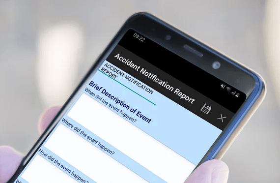
Storm/Emergency Response
Rapid-response form for emergency calls (fallen trees, flooding, accidents). Dispatch crews, capture photos, and document resolution.
Real-World Impact
A mid-sized local authority managing 800 miles of roads cut inspection cycles from quarterly to monthly by deploying inspectors with BORIS mobile forms. GPS timestamps eliminated disputes about completion. The council now responds to pothole reports within 48 hours and tracks repair crews in real time.
Maintenance spend dropped 15% because they prioritised work based on actual condition data rather than guesswork. Pre-built templates include Vehicle Pre-Start Check, Pothole & Defect Inspection, Driving Records, and Storm/Emergency Response forms.
Pricing & Next Steps
Start managing your road network with BORIS Freemium at no cost, or upgrade to Lite from £29.99 per user per month for GPS tracking, fleet management, and full mobile capabilities. Professional and Enterprise plans add advanced dispatch, route optimisation, and integration with asset management systems.
Facilities Management FAQs
Yes. GPS is enabled on all mobile forms. When a crew arrives at a job site and completes a form, the timestamp and location are captured automatically. You can audit where work happened and when.
Absolutely. Dispatch creates jobs and assigns them to crews. If an urgent call comes in, reassign the job and push it to the crew’s mobile. They see the updated job list, navigate to the new location, and complete the form on-site.
Create a custom Storm Response form capturing location, damage type, severity, and photos. Dispatch crews to multiple sites immediately. Mobile updates flow back in real time so you know which roads are passable and which are closed.